Operation Jailbreak and the Shift from Position to Intelligence
When the U.S. Army launched Operation Jailbreak at Fort Carson, the objective was clear: bring together industry, operators, engineers, and government stakeholders to accelerate interoperability across systems that have historically operated in isolation.
As Army leadership described it:
“Together, we will force our way through the firewalls, link every system, and achieve true right to integrate.”
The event brought together “defense heavyweights” and Army leadership to work through a challenge that extends far beyond any individual technology: how modern systems work together. TERN was honored to participate and was the only alternative PNT provider invited into the effort.
Operation Jailbreak was not focused on creating another standalone capability. It was focused on connecting capabilities that already exist. The goal was to create pathways between systems, reduce integration barriers, and allow information to move more effectively between platforms, operators, and command environments.
That objective shaped much of the work throughout the week.
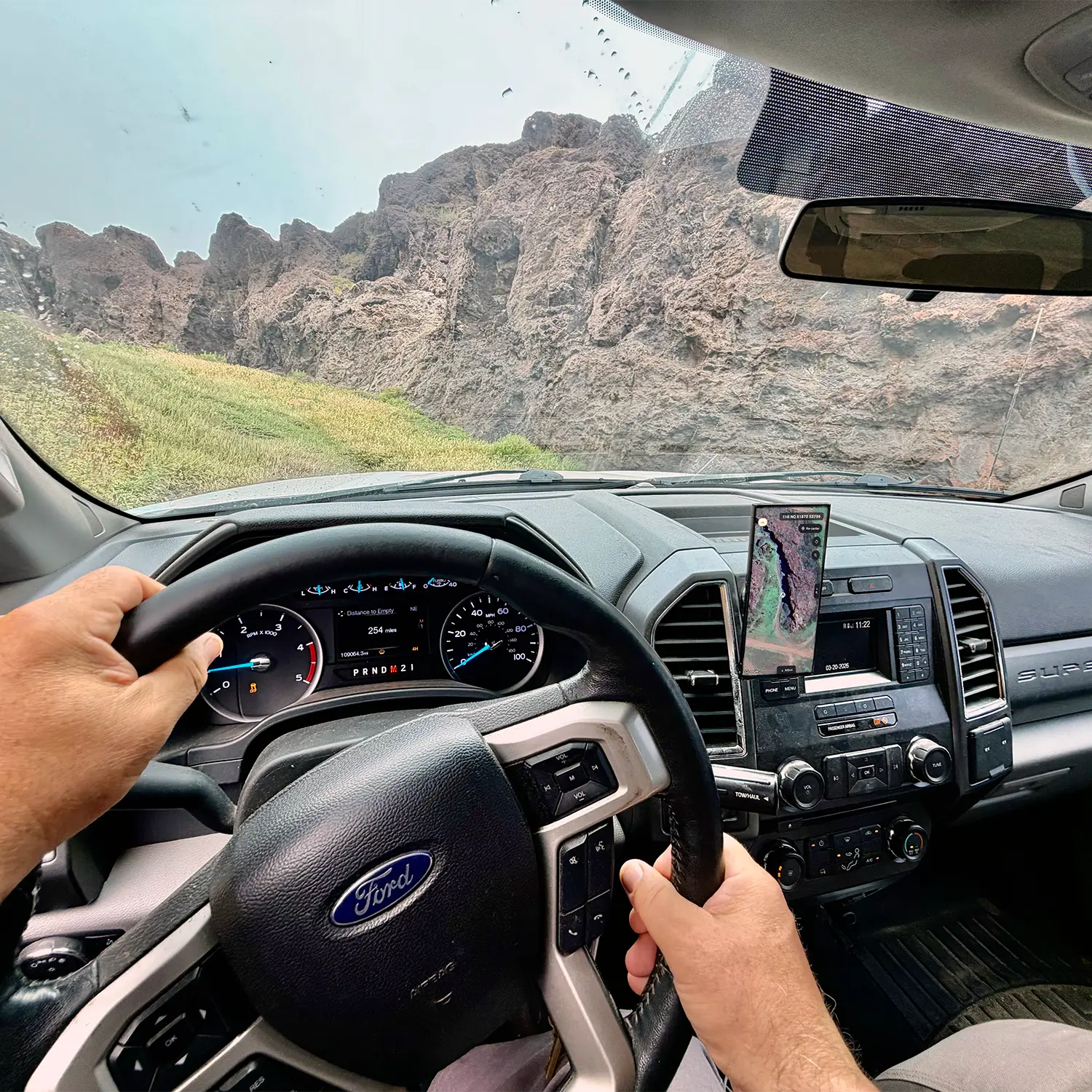
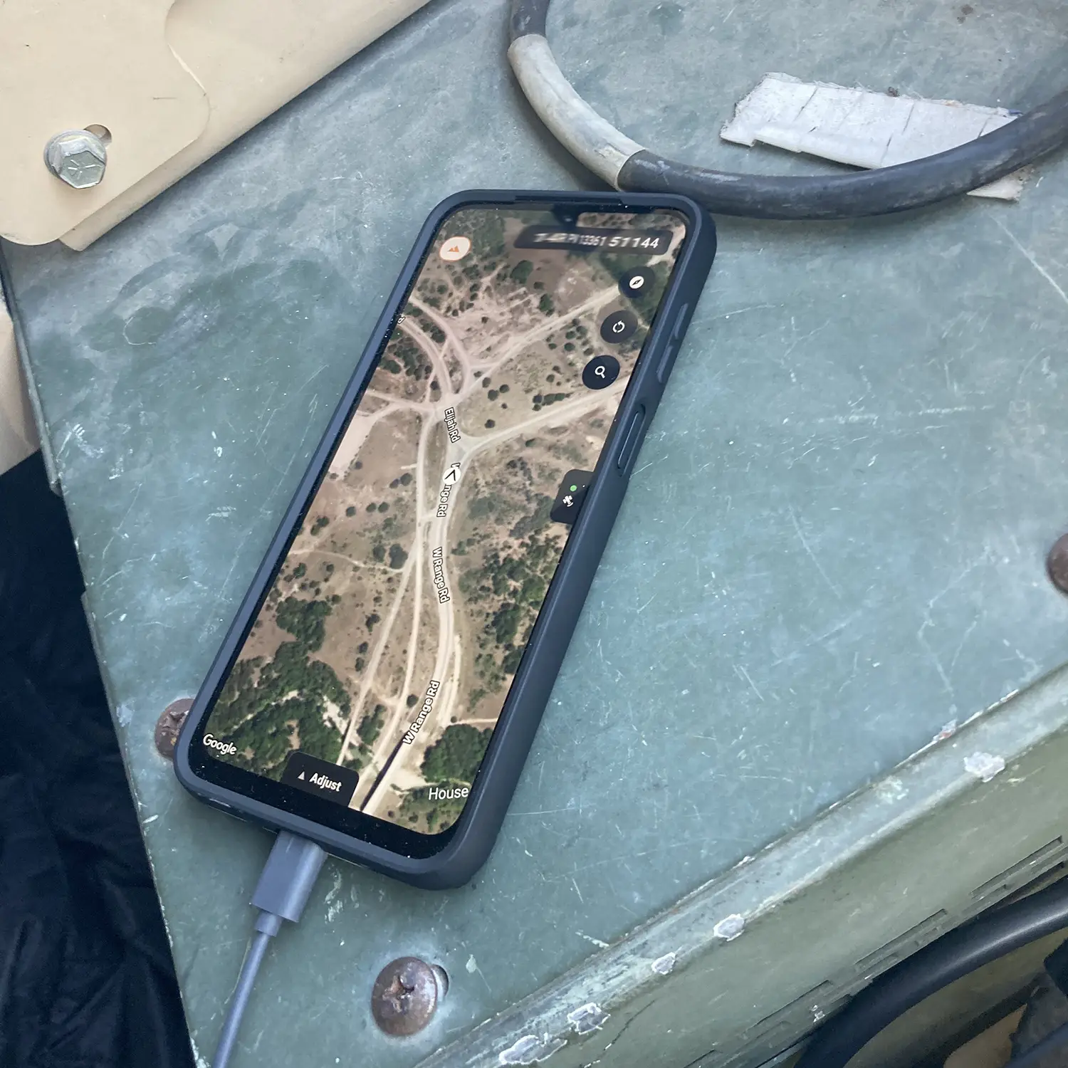
During the event, TERN integrated with Anduril, Palantir, and TAK while becoming part of the U.S. Army’s emerging Next-Generation Command and Control (NGC2) ecosystem. We also demonstrated bidirectional workflows that allow command systems to send routing instructions to vehicles while receiving positioning, vehicle status, and operational information in return. In parallel, we more broadly introduced our vehicle health capabilities that allow fleet status information to be surfaced alongside positioning information inside existing command environments.
Historically, positioning has often been treated as a service delivered to a system. A vehicle receives coordinates, a command system displays them, and other workflows operate around them. What surfaced throughout Operation Jailbreak was a different perspective.
Discussions with command-and-control providers, autonomy companies, unmanned systems manufacturers, and Army stakeholders rarely stayed focused on resilient alt PNT. The focus was less on the coordinate itself and what becomes possible when reliable spatial awareness is available across larger systems.
That perspective aligns closely with the vision TERN was built around. From the beginning, TERN was built around two related ideas:
The first was that position must remain continuously available. As systems become increasingly dependent on software, autonomy, and machine decision-making, losing awareness of place creates consequences that extend far beyond navigation. Most of the systems participating in Operation Jailbreak ultimately depend on knowing where they are in order to function as intended.
The second was that positioning itself needed to evolve. A coordinate delivered from outside the machine is fundamentally different from a machine-derived understanding of place. When a system derives position from its own motion, behavior, environmental context, and map intelligence, it is doing more than determining location. It is developing spatial awareness.
That distinction sits at the center of TERN’s approach.
The value is not simply that position remains available when infrastructure disappears. The value is that machine-derived spatial awareness creates a richer understanding of movement, context, relationships, and environment that can support the systems operating above it.
Throughout Operation Jailbreak, TERN demonstrated both sides of that architecture. The integrations with Lattice, Maven, TAK, and NGC2 showed how continuously available positioning can support larger operational systems. At the same time, routing workflows, vehicle health integrations, and bidirectional data exchange illustrated how machine-derived spatial awareness can contribute to command systems, autonomy platforms, fleet operations, and decision-making workflows that extend well beyond navigation.
Operation Jailbreak did not change TERN’s view of where positioning is headed. What it provided was a clear example of how broadly that view is beginning to resonate.
What many people think of as positioning is evolving into spatial intelligence.
Not because the coordinate itself has changed, but because the role it plays has changed.
As systems become more connected, autonomous, and software-defined, location is becoming more than a measure of where something is. It is becoming part of how machines understand movement, context, relationships, and the environment around them.
The significance of that shift extends well beyond defense. The same underlying requirement exists across robotics, autonomy, mobility, logistics, and any system that depends on understanding where it is and how it relates to the world around it.
Operation Jailbreak reinforced something TERN has believed from the beginning: continuously available position is foundational, but it is only the starting point. Enabling machines to develop a persistent, self-derived understanding of place and use that understanding to support the systems operating above them is the evolution from positioning to spatial intelligence.
ABOUT TERN: TERN’s positioning architecture has gained recognition across both commercial and government sectors, including selection into the NATO DIANA accelerator, contracts with the U.S. Department of Transportation and the U.S. Army, a Special Mention inTIME’s Best Inventions of 2025, and a win in the U.S. Army’s xTech Overwatch competition.
TERN is building a continuously learning positioning architecture that unlocks autonomy, mobility and spatial awareness by enabling vehicles to derive position from within, not above.